
Avant Case Study: Satellite Image (On-Demand) Moisture Analysis in Mato Grosso, Brazil
- Avant
- Mar 15, 2024
- 2 min read
Updated: May 20, 2024
Avant recently conducted a comprehensive satellite image analysis for a client in Mato Grosso, Brazil, showcasing the power of geospatial imaging technology in agriculture and environmental monitoring.

Geospatial Image Project Overview
The satellite image analysis focused on agricultural fields in Mato Grosso, a region known for its extensive farming activities. The objective was to monitor crop health, assess soil moisture levels, and identify areas requiring intervention. Avant utilised high-resolution satellite imagery and advanced image processing techniques to deliver precise and actionable data.
Data Collection and Image Analysis
The project involved the use of high-resolution satellite images, capturing detailed information about the fields. The images were processed and analysed using state-of-the-art techniques to extract meaningful insights.
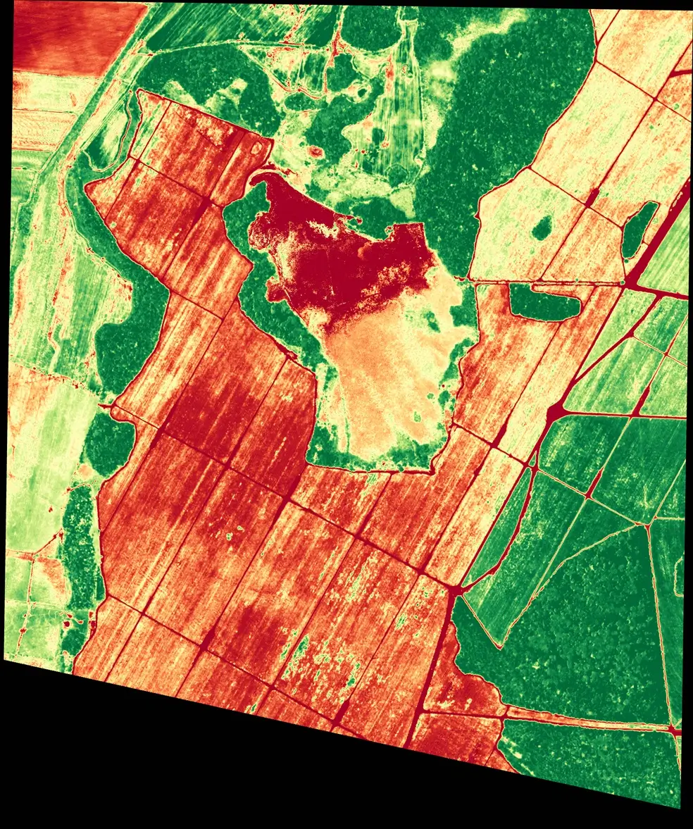

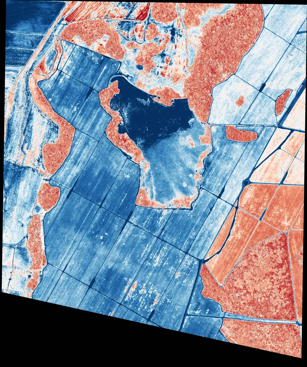
Image 1: False-Colour Infrared Imaging
False-colour infrared imaging renders infrared light which is invisible to the naked eye, this highlights differences in vegetation health not apparent in visible light.
In the first photo, healthy vegetation reflects more infrared and near-infrared light compared to unhealthy or sparse vegetation, making it appear bright red. This method is crucial for farmers and environmental scientists to assess plant health, manage irrigation more effectively, and monitor changes in ecosystems over time.
Image 2: High Definition Visual Spectrum Photography
The middle photo above provides a clear and intuitive view that helps in immediate assessments. It is essential for general mapping, visual inspection, and surveillance tasks, especially useful in real estate, urban planning, and public works to provide a realistic view of the area.
Image 3: Thermal Spectrum Analysis
Thermal spectrum analysis uses thermal imaging to detect heat variations in the environment, which can be critical for various applications including environmental monitoring and urban planning. In the third photo, this technology highlights water temperature variations in blue and surrounding land in red. It is particularly useful for analysing moisture levels, land use, and detecting heat signatures from different materials, aiding in decisions related to agriculture and irrigation management.
Applications and Benefits
Agricultural Management:
The insights gained from the satellite image analysis are crucial for effective agricultural management. By understanding soil moisture levels and crop health, farmers can optimise irrigation practices, improve crop yields, and reduce water usage. This leads to more sustainable farming practices and better resource management.
Environmental Monitoring:
The project also contributes to environmental monitoring by providing data on land use and vegetation cover. This information is essential for assessing the impact of agricultural activities on the environment and planning conservation efforts.
Decision-Making Support:
The detailed analysis supports decision-making at various levels, from individual farmers to policymakers. Accurate data on soil moisture and crop health allows for timely interventions, reducing the risk of crop failure and improving overall agricultural productivity.
Avant's successful completion of this project highlights the company's expertise in geospatial imaging and data analysis. By leveraging advanced technologies, Avant provides clients with precise, actionable insights that drive better decision-making and resource management.
Avant's satellite image analysis in Mato Grosso, Brazil, shows the power of geospatial imaging technology in agriculture and environmental monitoring. Avant helps clients optimise resource management, improve agricultural practices, and support environmental conservation.
Comments